
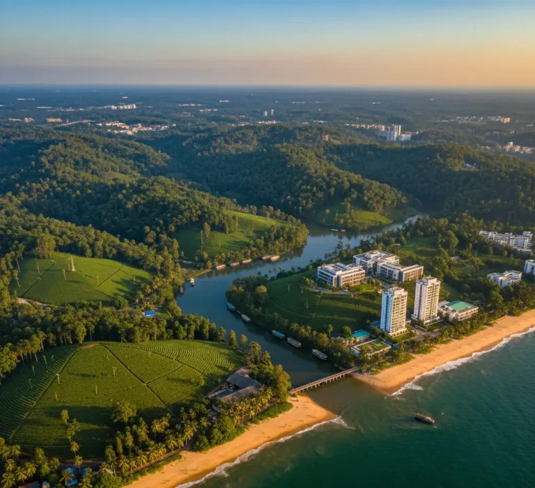
What is Aerial Photography?
The technique of taking pictures of the ground, scenery, or buildings from a higher altitude, typically from the air, using equipment like drones, airplanes, helicopters, or satellites, is known as aerial photography.
It provides photographers and businesses with a bird’s-eye view that cannot be obtained from the ground, as well as unique views, size, and contextual information.
Types of Aerial Photography
Oblique Aerial Photography: Photos taken at an angle rather than directly overhead.
Types:
- High oblique: Shows the horizon and gives a perspective view of the terrain.
- Low oblique: Focuses more on the subject without including the horizon.
- Uses: Real estate, tourism promotion, and landscape photography.
Vertical Aerial Photography: Photos taken straight down from above (90° angle).
- Uses: Mapping, surveying, urban planning, agriculture, and GIS (Geographic Information Systems).
Tilted or Modified Aerial Photography: Combines aspects of oblique and vertical photography for specialized purposes.
- Uses: Photogrammetry, 3D modeling, and detailed mapping.
Drone Photography: Modern aerial photography using drones for flexible and affordable aerial shots.
- Uses: Real estate, marketing, events, cinematography, inspection, and tourism.
Satellite Aerial Photography: Captured from satellites orbiting the Earth.
- Uses: Environmental monitoring, mapping, disaster management, and weather forecasting.
Balloon or Kite Aerial Photography: Captured using cameras attached to balloons or kites.
- Uses: Surveying remote areas, creative photography, and environmental studies.
Aerial Photography in India
Aerial photography in India has grown significantly due to developments in drone technology, legislative support, and a wide range of uses across industries. From capturing the architectural marvels of ancient structures to monitoring agricultural fields, aerial imagery provides unmatched perspectives and insights.
Principles of Aerial Photography
Aerial photography principles guarantee the accuracy, clarity, and utility of photos taken from above. Comprehending these concepts is crucial for uses such as scientific study, mapping, and surveying.
- Scale:
- The scale is the ratio of a distance on the photograph to the corresponding distance on the ground.
- Scale depends on flying height and the focal length of the camera.
- Maintaining a consistent scale is important for mapping and measurements.
- Geometry of Photography
- Aerial photos are affected by the position of the camera, altitude, and terrain relief.
- Vertical photographs minimize distortion and are preferred for mapping, while oblique photographs give perspective views.
- Coverage and Overlap
- Forward overlap: Consecutive photos overlap by 60–80% along the flight line.
- Side overlap: Adjacent flight lines overlap by 20–30%.
- Overlaps allow the creation of stereoscopic images for 3D viewing and accurate measurements.
- Orientation
- The camera should be properly oriented with respect to the terrain.
- Tilt must be minimized in vertical photos to avoid distortions.
- Orientation affects accuracy in measurements and mapping.
- Stereoscopy
- Taking overlapping photos allows stereoscopic viewing, giving a 3D perception of the terrain.
- Essential for topographic mapping, elevation measurement, and construction planning.
- Ground Control and Reference
- Using ground control points (GCPs) ensures the photographs can be correctly scaled and referenced on maps.
- Helps in accurate georeferencing and measurement.
- Timing and Lighting
- Aerial photography is influenced by sun angle, shadows, and atmospheric conditions.
- Optimal lighting ensures clear, sharp images without distortion.
Factors Affecting Aerial Photography
The quality, clarity, and use of aerial photos are influenced by a number of factors. Understanding them assists in planning and carrying out successful aerial photography missions.
- Weather and Atmospheric Conditions
- Clouds, fog, haze, or dust can reduce visibility and clarity.
- Wind speed affects the stability of the aircraft or drone.
- Clear, sunny days are ideal for sharp images.
- Time of Day / Sun Angle
- The position of the sun affects shadows, contrast, and illumination.
- Mid-morning or mid-afternoon is usually best to avoid long shadows.
- Low sun angles can create dramatic shadows but may distort details.
- Altitude / Flying Height
- Determines the scale and coverage area of the photograph.
- Higher altitude covers more area but reduces detail; lower altitude increases detail but covers less area.
- Camera and Lens Characteristics
- Focal length, aperture, and sensor resolution affect image quality.
- High-quality lenses reduce distortion and improve sharpness.
- The type of camera (digital, film, infrared) determines the type of data captured.
- Flight Path and Orientation
- Correct flight line planning ensures proper overlap and coverage.
- Camera tilt or orientation can cause distortions if not controlled.
- Terrain and Ground Relief
- Uneven terrain can cause scale variations in vertical photos.
- Hilly or mountainous areas may require special planning for accurate coverage.
- Stability of Aircraft or Drone
- Vibrations or sudden movements affect image sharpness.
- Stabilized cameras or gimbals help maintain clarity.
- Type of Photography
- Vertical vs. oblique photography determines perspective and the type of distortions expected.
Uses of Aerial Photography
Aerial photography offers a perspective of the Earth from above, which is useful in a variety of industries. Its uses can be practical, commercial, and scientific.
- Mapping and Surveying
- Creating topographic maps and contour maps.
- Land surveys for urban planning and construction.
- Boundary demarcation for property or governmental purposes.
Agriculture and Forestry- Monitoring crop health, irrigation, and soil conditions.
- Detecting pest infestations or disease in plants.
- Forest mapping, tree density analysis, and deforestation tracking.
- Urban Planning and Infrastructure
- Planning roads, bridges, and urban layouts.
- Monitoring construction progress.
- Managing traffic and land use planning.
- Disaster Management
- Assessing damage after floods, earthquakes, or storms.
- Coordinating relief operations.
- Identifying safe routes and affected areas.
- Military and Defense
- Reconnaissance and surveillance.
- Planning strategic operations.
- Monitoring border areas or hostile territories.
- Environmental Studies
- Tracking pollution, erosion, and natural resource changes.
- Monitoring coastal areas and wetlands.
- Wildlife habitat assessment.
- Real Estate and Tourism
- Showcasing properties from above for marketing.
- Highlighting tourist destinations, resorts, and natural landscapes.
- Archaeology and Heritage Conservation
- Discovering ancient sites and monuments.
- Documenting heritage sites for restoration.
- Cinematography and Photography
- Capturing movies, documentaries, and commercials.
- Creating creative and dramatic visual effects.
Advantages & Benefits of Aerial Photography
- Broad Area Coverage
- Captures large areas in a single shot.
- Useful for mapping, urban planning, and agriculture.
- Unique Perspective
- Offers views and angles not possible from the ground.
- Enhances visual appeal for marketing, tourism, and cinematography.
- Accurate Data Collection
- Helps in surveying land, forests, and construction sites.
- Allows precise measurements for mapping and planning.
- Time and Cost Efficiency
- Faster than traditional ground surveys.
- Reduces the need for extensive manpower in large-area inspections.
- Disaster Assessment and Management
- Provides real-time images after floods, earthquakes, or storms.
- Assists in rescue operations and damage assessment.
- Environmental Monitoring
- Tracks deforestation, soil erosion, water bodies, and wildlife habitats.
- Supports sustainable resource management.
- Versatility Across Industries
- Applicable in real estate, agriculture, defense, construction, tourism, and archaeology.
- Serves both commercial and research purposes.
- Safety Advantages
- Can inspect hazardous or hard-to-reach areas without putting people at risk.
- Can inspect hazardous or hard-to-reach areas without putting people at risk.
- Enhanced Marketing and Visualization
- Creates eye-catching visuals for promotions, tourism, and real estate.
- Helps clients visualize large projects or landscapes effectively.
Disadvantages of Aerial Photography
- Weather Dependence
- Photography is heavily influenced by clouds, fog, rain, or haze.
- Poor weather can reduce image clarity and visibility.
- High Cost
- Using aircraft, helicopters, or drones can be expensive.
- Advanced equipment like high-resolution cameras and stabilizers adds to costs.
- Limited Flight Time
- Aircraft and drones have restricted operating hours and battery life.
- Long-duration projects may require multiple flights.
- Safety Risks
- Risk of accidents during flight or drone malfunctions.
- Strict safety protocols must be followed.
- Technical Expertise Required
- Requires skilled pilots/drone operators and trained photographers.
- Post-processing and analysis of aerial images need specialized knowledge.
- Distortion and Accuracy Issues
- Photos can have scale variations or distortions due to camera tilt or terrain relief.
- Requires careful planning and ground control points for mapping purposes.
- Legal and Regulatory Restrictions
- Operations are subject to airspace regulations, permissions, and drone laws.
- Violating regulations can lead to penalties or legal issues.
- Limited Detail for Small Objects
- High-altitude photography may miss small details, reducing its usefulness for detailed inspections.
Importance of Aerial Photography
- Provides a Bird’s-Eye View
- Offers a broad and detailed perspective of large areas that cannot be easily captured from the ground.
- Helps in understanding geographical relationships and spatial patterns.
- Aids in Accurate Mapping and Surveying
- Forms the basis for topographic maps, land-use maps, and urban plans.
- Ensures accuracy and up-to-date data for engineers, planners, and geographers.
- Supports Urban and Regional Planning
- Helps authorities plan roads, housing, and infrastructure effectively.
- Assists in monitoring urban growth and managing land resources.
- Helps in Environmental Monitoring
- Tracks deforestation, soil erosion, water resources, and ecosystem changes.
- Essential for climate and conservation studies.
- Useful in Agriculture and Forestry
- Monitors crop health, irrigation patterns, and forest cover.
- Helps improve productivity and sustainable management of natural resources.
- Assists in Disaster Management
- Provides quick damage assessments after floods, earthquakes, or cyclones.
- Helps authorities plan relief operations efficiently.
- Valuable for Archaeology and Heritage Preservation
- Reveals hidden structures or ancient sites not visible from the ground.
- Useful for documentation and conservation of cultural heritage.
- Enhances Business and Marketing Efforts
- Used in real estate, tourism, and advertising to showcase locations attractively.
- Adds a visual storytelling element that boosts audience engagement.
Why TLM Studios for Aerial Photography
At TLM Studios Pvt Ltd, the best creative agency in Kerala, we use creativity, technology, and narrative to bring your vision to life through breathtaking aerial photography. Our team specializes in creating magnificent visuals that emphasize landscapes and architecture while also conveying emotion and purpose.
We guarantee that every shot exhibits accuracy and artistry with our sophisticated drone technology, skilled photographers, and acute creative vision. Our aerial photography gives your business a distinctive viewpoint that speaks volumes, whether it is being used for marketing campaigns, corporate initiatives, real estate, or tourism. With the right creative agency in Kerala, the possibilities are endless, so choose us to improve your brand.